ST. CATHARINE!!
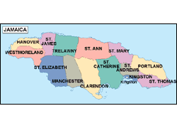


St. Catherine is located on Jamaica's southern coast. It is to the west of St. Andrew, to the east of Clarendon and to the south of St. Mary and St. Ann. It has an area of 1,192.4 sq. km with a population of approximately 362,000. This parish was formed in 1534 when the boundaries of St. Catherine were expanded to incorporate the former parishes of St. Dorothy, St. John and St. Thomas-in-the-Vale.
St. Catherine is one of the most stable parishes in Jamaica in terms of industrial development. St. Catherine is also recognised as a self sufficient parish as it has large fertile basins stretching from Linstead in the centre to Guy's Hill in the North.
Special Attractions
![]() Caymanas Race Track
Caymanas Race Track
![]() Caymanas Golf and Country Club
Caymanas Golf and Country Club
![]() Nature's Habitat
- is a fishing ground were the public can come and catch fish from
artificial ponds.
Nature's Habitat
- is a fishing ground were the public can come and catch fish from
artificial ponds.
![]() White
Marl Arawak Museum
- is constructed in the style of an Arawak Indian hut. Displays of Arawak
culture can be seen.
White
Marl Arawak Museum
- is constructed in the style of an Arawak Indian hut. Displays of Arawak
culture can be seen.
![]() Green
Bay
- is a firing range for the Jamaica Defence Force.
Green
Bay
- is a firing range for the Jamaica Defence Force.
![]() St. Clair's Cave
- is one of Jamaica's more famous caves.
St. Clair's Cave
- is one of Jamaica's more famous caves.
![]() Jamworld - the home of Reggae Sunsplash.
Jamworld - the home of Reggae Sunsplash.
![]() Ferry Inn - was built in 1684 as a tavern for the wealthy.
Today the inn is still used as a place for refreshments and recreation.
Ferry Inn - was built in 1684 as a tavern for the wealthy.
Today the inn is still used as a place for refreshments and recreation.
![]() Port
Henderson
- is a fishing village dating back to the 18th century. Several historic
buildings which have been preserved as national monuments can be found here.
Port
Henderson
- is a fishing village dating back to the 18th century. Several historic
buildings which have been preserved as national monuments can be found here.
![]() Colbeck
Castle
- was built in the 18th century. It was partially destroyed by fire.
Colbeck
Castle
- was built in the 18th century. It was partially destroyed by fire.
COPYRIGHT©2006 ALL RIGHT RESERVED MAUREEN B INC